Using 3D for environmental defense
Meet Julian Pearson, a parish councilor in Norfolk, United Kingdom using SketchUp in a very unique way... for environmental protection. Although Julian is only an amateur with SketchUp, he doesn’t let that hold him back from diving into the 3D details. Read along to learn how he is combating negative environmental impacts from a proposed power plant substation (the largest in Europe) with a little help from SketchUp.
Give us some background on your project and how you got started.
Several years ago, Vattenfall, a Swedish multinational power company owned by the Government of Sweden, proposed the building of a new power substation and connection to the national grid, in the middle of Norfolk farmland. The proposed site was on top of one of the highest points in the county and included four very intrusive buildings. Each site was larger than the playing field at Wembley Arena, England’s national stadium, and threatened the surrounding environment, visible for several miles in all directions. I got involved because I live nearby and wanted to ensure this substation was following standard procedure by being thoroughly researched, examined, and mitigated before the final build. I quickly discovered if the plant was moved ½ a mile from its proposed location that the negative factors (appearance and visual impact) would be completely removed. I needed a way to visually show this proposed change to the Examining Authority of the Planning Inspectorate. The Planning Inspectorate is the person that investigates these issues and makes recommendations to the Secretary of State, who makes the final decision.
The proposed site with the surrounding topography.
Why did you choose to use SketchUp for this project?
I thought SketchUp would be the best tool to visually communicate my proposed changes. I discovered new ways of working with SketchUp through my friend, Kent Morrison, whom I had met through a Facebook SketchUp forum. He is a certified 3D content developer for SketchUp so he knows modeling best practices. I asked him to help me figure out the best ways to display my models to the Planning Inspectorate.
Originally, I wanted to distribute a KML file and ask viewers to look at it via Google Earth. He proposed a different, more accessible presentation technique using Cesium. Cesium is a 3D geospatial, web-based platform so it required an ultra-lean model. Kent helped me convert model geometry into Components which reduced the size of my file significantly, but I wanted to further reduce the size. I was able to create a 55m high, fully 3D pylon with just 22 facets. I also made it completely transparent so I could see the changing landscape as the video moved around to show the buildings compared to the pylons. This would not have been possible with the thousands of facets a single, true pylon would have... we nicknamed it “2 ½ D”.
Using Cesium to show how the towers would dominate the view corridor.
Talk to us about some of the challenges you encountered.
We had to deal with a lot of political and legal bureaucracy, and thus, had to ensure our materials were up to par and accurate. When Vattenfall originally submitted documentation, they had split the complex in half and submitted it as two separate applications. My drawings had to follow this structure and they had to look similar; for example, using the same colors.
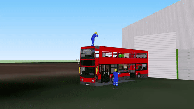
Once I had completed my drawings, I was unable to submit them because I had used the Cesium server. All submissions to the Planning Inspectorate had to be in a standard PDF or JPG file format and any links outside of that were not allowed. After speak with the Planning Inspectorate, I finally found a solution using AVI files, but quickly ran into another issue -- a complete lack of lidar data for the location of the proposed site. I didn’t have the time or resources to capture this data. As a solution, I used Google Maps inside of SketchUp to pull in this data.
Pulling in the data from Google Maps.
Talk to us about your workflow with SketchUp and Google Maps for this project.
I started off by recreating pre-existing buildings based on dimensions from Google Maps and street view images. I also was able to track down the original Architect for some of the surrounding buildings. He gave me the plans and dimensions I needed to recreate these in SketchUp. Some of the existing buildings I included in my model were:
Dudgeon, a pre-existing substation at the same geographic location. Since these were recognizable buildings, the on-site inspections used these buildings as a location finder to assess where the Vattenfall buildings would go. All of these buildings, plus those of the proposed cable depot, Orton barns (a large campus of buildings which would store and manage the distribution of 280 miles of ducting and cabling), fit inside just one of Vattenfall’s convertor buildings -- with plenty of room to spare.
Necton barn, the largest pre-existing barn in the same village as the substation. This barn is owned by the same family that owns the land that Vattenfall planned to purchase.
Wembley Stadium, England’s national stadium for football. I imported this stadium from 3D Warehouse and a birds-eye view snapshot from Google Maps to help put the proposed buildings into perspective. In my research, I discovered the stadium has a pitch just 2 meters narrower and 4 meters shorter than the footprint of one of the proposed power converter buildings.
After all of your work and research, what was the final decision from the commission?
Once I was done with the model, I registered with the Planning Inspectorate as an interested party. I was a parish councilor at the time so I was invited to make presentations to the examining authority that was made up of lawyers. This was held in public and officially recorded for those unable to attend in person.
I was not present at the High Court hearing for the judicial review of the decision but was told that the SketchUp submissions were used as part of the original documentation to demonstrate the devastating impact of the development.
The High Court quashed the planning consent given a few months earlier and returned the application to the Secretary of State. In brief, the grounds for overturning the consent was because the Secretary of State had failed to consider the ‘cumulative effect’ of not only the entire development but also the pre-existing Dudgeon substation. The Secretary of State has since sent all interested parties a letter asking for ideas on how he should proceed.
Ground view of the proposed site.
What do you see as the benefit of SketchUp for this type of use?
As I see it, I am just a low-skilled amateur, but the simplicity of SketchUp allowed me to demonstrate things that the applicant had been unable to provide to the Planning Inspector. This helped us make a case to oppose the proposed 3.6GW substation without fully detailed infrastructure design and mitigation measures to reduce the visual impact. If I can do this, anyone can!